Interactive Atlas
Advertisement
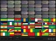
FlagScholar v.1.3
Fun and addictive game for learning the flags of the world. Race against the clock for points! Mouse game: Drag flag pictures to matching country names. Keyboard: Type the name of the displayed flag. Atlas: Interactive atlas of the world.
Advertisement
AgroAtlas v.1 1
The Atlas of Agrobiological Resources of Russia and Neighbouring Countries (hereunder the Agroatlas) contains descriptive and cartographic information about agroecological conditions, main cultivated crops and their wild congeners, diseases, pests

Interactive Dali Screensaver
Besides functioning as a regular screensaver, Interactive Dali Screensaver gives you the unique opportunity to become a Dali for yourself. Screensaver includes 33 mixes based on original painting "Dream Caused by the Flight of a Bee Around a Pomegranate
Atlas v.14. 10. 2001
Atlas 2.0.0.0 computes the resulting moments and reaction forces for a given beam with loads applied to it. The program uses the Cross' method, the loads can be single or distributed.
ATLAS.ti v.6 2
ATLAS.ti is a powerful workbench for the qualitative analysis of large bodies of textual, graphical, audio and video data. Sophisticated tools help you to arrange, reassemble, and manage your material in creative, yet systematic ways. ATLAS.
IMapBuilder Interactive Flash Map v.6 25
iMapBuilder is an all-in-one software that creates interactive Flash map.
DIGITAL COLOUR ATLAS v.3.0
The DIGITAL COLOUR ATLAS is a complete package for your work with colour. You can compare colours and colour systems, calculate harmonies, match colours. There were measured 200,000 colour samples for this software.
NT Interactive Support Centre v.2 5
New Technology CADCAM, the UK's leading provider of the highly affordable, premier design software; SolidWorks, launches a new Interactive Support Centre to meet its customers needs.
TI InterActive v.1 3
TI InterActive! brings the power of TI graphing calculators to your computer, including significant functionality.
3D World Atlas v.1.0
This 3D World Atlas software allows you to explore the world from your own home. The grapichs are in 3D, which make it more interesting. It has truly incredible graphics. You will enjoy to look around it with your children.
Terran Atlas v.2.0
Terran Atlas screen shotThe Terran Atlas database now has over 13 million records of city, latitude and longitude information for 250 countries, making it the largest database in the field.